
Canton ZIP Directory Coverage
Two delivery codes serve the broad Canton postal area, while a third code is an older PO-box clue. The descriptions below are intentionally broad. No official source reviewed for Canton maps every neighborhood to a ZIP polygon, so a street assignment should always be checked through USPS rather than inferred from a neighborhood name.
| ZIP Code | Areas Covered | Post Office | Notes |
|---|---|---|---|
| 30114 | Main, Riverstone, and broad western and northern Canton postal areas | Canton Main Post Office | Extends beyond land proven to be inside the city |
| 30115 | Broad eastern and southeastern postal areas, including the Hickory Flat vicinity | Canton postal operations | Includes unincorporated Cherokee County |
| 30169 | Historical Canton PO boxes | Canton postal grouping | Verify current validity; not residential geography |
The Canton Main Post Office is at 2400 Riverstone Boulevard and lists 770-720-8164. Its street address is useful for identifying the station, not for defining the edge of 30114. The 30115 label likewise covers both city and county places. A Canton ZIP code directory can narrow a search, but it cannot certify municipal jurisdiction.
Canton ZIPs Changed in 2012
USPS moved exactly 1,184 deliveries from 30114 to 30115 on July 1, 2012. That verified change creates a useful continuity rule for property, newspaper, and family research. When an address appears on both sides of that date, search both ZIP forms while holding the street name, house number, and parcel facts steady.
The official Postal Bulletin notice documents the realignment. It describes a postal change, not a citywide street renumbering. No authoritative evidence of a Canton-wide renumbering was found, so the ZIP shift should never be recast as one.
Continuity clue. A changed ZIP after July 2012 may describe the same physical Canton property rather than a household move.
Search Canton ZIP Codes at USPS
The official USPS ZIP Code Lookup has three different search modes. Use the address tab for one deliverable location, city and state to list codes associated with Canton, or cities by ZIP to see the acceptable and preferred city names tied to a code. The result confirms routing. It does not confirm that any person or company occupies the address.
Open the USPS lookup before comparing resident records.
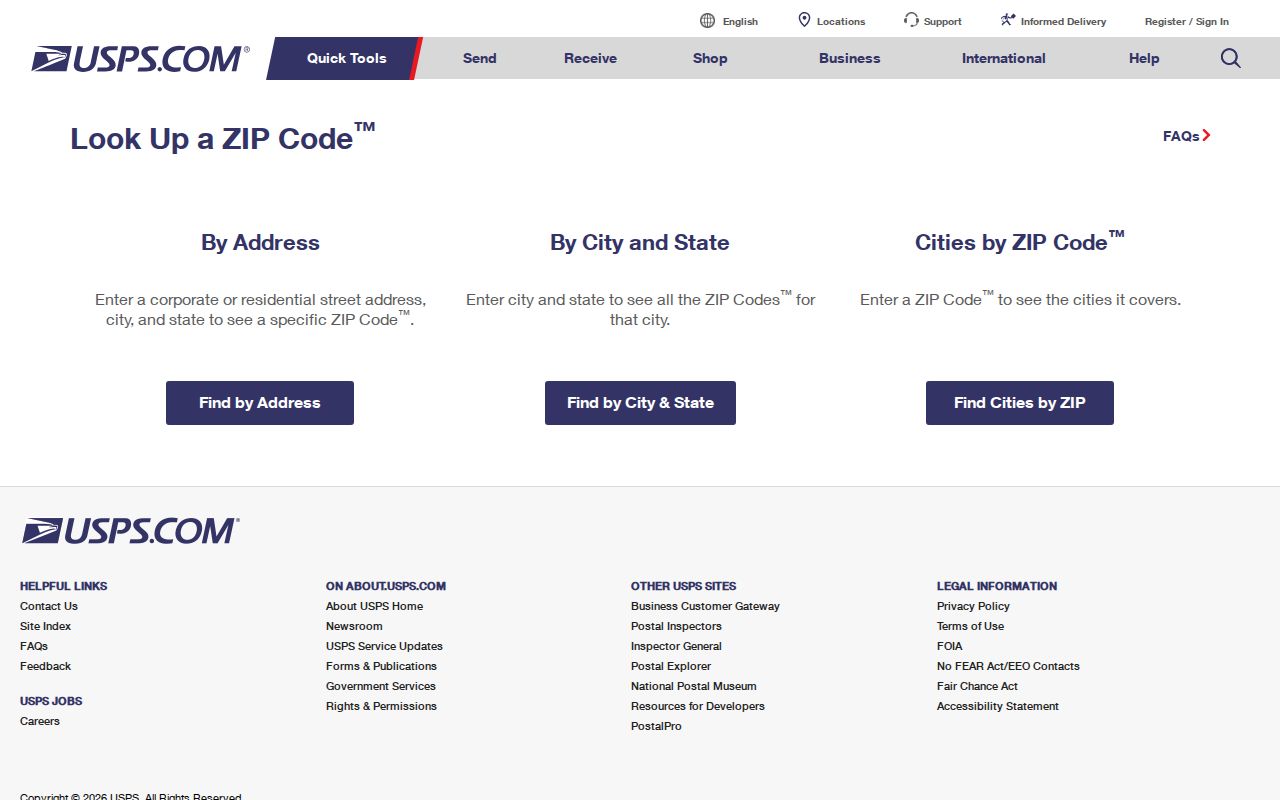
The captured interface shows why the search mode matters: an exact unit can resolve ambiguity that a city-wide request cannot.
| USPS field | Input and use | When required |
|---|---|---|
| Search mode | By Address, By City and State, or Cities by ZIP Code | Always |
| Street Address | Street number and name | Address mode |
| Apt/Suite/Other | Unit detail that narrows shared addresses | Optional |
| City and State | Canton and Georgia | City/state mode or when ZIP is omitted |
| ZIP Code | Five digits | Cities-by-ZIP mode |
Find Canton Residents by ZIP
No official Canton source produces a public roster merely from a ZIP. USPS verifies mail routing, the assessor works best from a situs address or parcel, and Georgia My Voter Page is an identity-gated self-lookup. A careful ZIP code directory workflow narrows geography without claiming more than those sources show.
- Verify the full mailing line with USPS, including any apartment or suite.
- Search the Cherokee County Spatialest property roll by situs address or map area. Do not assume it offers a ZIP-wide owner list.
- Open county or city GIS and compare the parcel with municipal, tax-district, and nearby street layers.
- Use the owner name, PIN, or legal description for deed research. Use the state voter portal only for the person-specific self-lookup it permits.
Once the result narrows to a named road, the Canton street directory explains the address-level record chain. That handoff avoids treating a postal region as if it were a list of households.
Canton Records Use Different Addresses
A postal address is only one representation of a property. The assessor and permit offices key work to the physical, or situs, address. Tax notices go to an owner mailing address that may be somewhere else. Deeds rely on a legal description, and the parcel system assigns its own PIN or TIN. Keeping each field separate prevents a false match.
- ZIP Code
- A five-digit USPS routing code, not a city boundary.
- ZIP+4
- A more precise delivery segment appended to the five-digit code.
- PO-box ZIP
- A code used for post-office boxes rather than mapped residential land.
- Carrier route
- A delivery path within a postal code, not a public resident roll.
- Situs address
- The physical location used by assessor, GIS, and permit records.
The legal description is the best bridge when a postal code changes. Land lot, district, subdivision, lot, block, and plat references can stay stable even when the last line of the mailing address does not.
Historical Canton ZIP Code 30169
A 2003 Postal Bulletin records that USPS established 30169 for a portion of Canton PO boxes formerly assigned to 30114, effective September 30, 2002. It is a research clue, not a residential search zone. Verify whether the code is still valid before using it on current mail.
Old business cards, correspondence, association files, or directory entries may preserve 30169. That evidence can date a mailing practice, but it cannot place a person on a parcel. Compare the name and box with later street records before treating the match as the same resident.
Canton ZIPs Versus City Limits
Postal Canton extends outside the incorporated city. Cherokee County GIS says city boundaries are updated from annexation information supplied by municipalities, while Canton maintains an official city-limits layer from approved annexation and de-annexation records. The layer reported an annual refresh on July 21, 2026.
For jurisdiction, compare the parcel with the official Canton city-limits layer. For delivery, rely on USPS. A 30114 or 30115 line alone cannot tell whether a permit request belongs with the city or Cherokee County.
Boundary warning. Never use a Canton ZIP code as proof that an address falls within Canton municipal limits.
Why Canton Deeds Need More
Recorded deeds rarely begin with a ZIP search. Cherokee County Landmark indexes names, document types, dates, book and page, clerk file numbers, and legal-description fields. Convert a postal address to its parcel record, then carry the owner, PIN, deed book and page, plat, and land description into the recorded-document search.
This route also survives the 2012 postal shift. The same parcel may appear with two ZIP forms, yet the subdivision, lot, land district, and recorded book-page trail still identify the land. Landmark covers online information from 1989 forward and directs earlier index work to OnPoint or the public counter.
Canton ZIP Directory Limits
Official sources do not support an exact neighborhood-to-ZIP atlas for all Canton streets. Nor did the research find a verified citywide street-renumbering event. Broad phrases such as western Canton or the Hickory Flat vicinity help orient a search, but they are not substitutes for an address result.
Historic newspapers can be searched for modern ZIP numbers, though older issues predate ZIP Codes and work better with a name, street, spouse, school, church, or employer. Voter data also has strict limits: My Voter Page is not browsable by ZIP, and purchased lists remain subject to Georgia law and protected-address rules.
A sound Canton ZIP code directory result stops at what each source proves. USPS proves routing. GIS shows mapped jurisdiction and parcels. The assessor identifies the assessed owner, not every occupant. Deeds document title transactions. Combining them carefully produces a useful local answer without turning one postal clue into an unsupported household claim.